Pont du Tarn - PONT DE MONTVERT - SUD MONT LOZERE
Foot
Pont du Tarn
48220 PONT DE MONTVERT - SUD MONT LOZERE
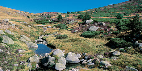
Typical Mont Lozère hamlets such as L'Aubaret or Troubat, in the central zone of the Cévennes National Park, bear witness to a life of self-sufficiency. At the Pont du Tarn, you can cool off in the pure and invigorating waters of the Tarn, not far from its spring.
Reception
Min height : 1033 m
Max height : 1365 m
Natural regions : Mont Lozere
Territories : National Park of the Cevennes
Document language : French
Itinerary
Beacon : Yellow PR
Level : Hard
Distance : 16.278 km
Duration in hours : 07:00 h
Negative difference : 564 m
Positive difference : 561 m
Loop itinerary : yes
Access : 5 km from Le Pont-de-Montvert, on the D 998 towards La Croix de Berthel. At La Baraquette, turn off to Masméjean As you leave the hamlet
Useful tips
The Alignon ford may be impassable when the river is in flood. If necessary, continue on the road instead. Make sure your equipment is appropriate for the day's weather conditions. Remember that the weather changes quickly in the mountains. Take enough water, wear good shoes and put on a hat. Please close all gates and barriers after yourself.
OFFICE DE TOURISME CEVENNES AU MONT-LOZERE
PONT DE MONTVERT - SUD MONT LOZERE
Information updated on 22/12/24 / Report an error on this offer !


