GR®700: the Régordane Way - LA BASTIDE-PUYLAURENT
Foot
GR®700: the Régordane Way
48250 LA BASTIDE-PUYLAURENT
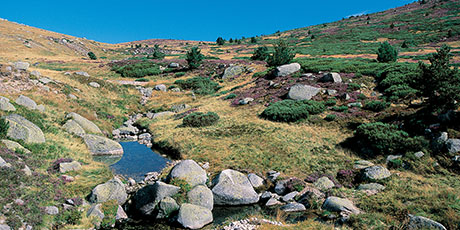
The Régordane Waywas absolutely central to circulation in Antiquity and the Middle Ages. As you hike it, you can explore the movement of people, merchandise and ideas at each stage. The Régordane Way still bears the traces of the fight for freedom of conscience and the successive challenges that it brought to the Catholic Church: Arianism, Catharism and Protestantism. It runs through very diverselandscapes, beginning with coniferous forests and lava flows in the norththat are gradually replaced by sweet-chestnut trees, broom and holm oak, and then by garrigue(Mediterranean scrubland)as you approach the Petite Camargue.
Reception
Min height : 293 m
Max height : 1137 m
Natural regions : Margeride • Cevennes • Mont Lozere
Document language : French
Itinerary
Beacon : White and red GR
Level : Medium
Distance : 54.9345 km
Duration in days : 3 j
Negative difference : 2296 m
Positive difference : 1614 m
Loop itinerary : no
Useful tips
N.B.: For a variety of reasons, the actual way-marks can differ from the route described in the guidebook. Please follow the way-marks. Make sure your equipment is appropriate for several days of hiking, but also for the day's weather conditions. Remember that the weather changes quickly in the mountains. Take enough water, wear hiking shoes and put on a hat. Close all gates and barriers after yourself.
1. From COSTAROS to LANGOGNE
Distance : 25Km
Duration : 07:00
2. From LANGOGNE to LA BASTIDE-PUYLAURENT
Distance : 24,5Km
Duration : 06:00
3. From LA BASTIDE-PUYLAURENT to VILLEFORT
Distance : 22Km
Duration : 05:30
4. From VILLEFORT to GENOLHAC
Distance : 14Km
Duration : 03:00
LA BASTIDE-PUYLAURENT - OFFICE DE TOURISME DE VILLEFORT
LA BASTIDE-PUYLAURENT
Information updated on 06/01/25 / Report an error on this offer !


